

Palestine Map Transformation Since 1946
Figure below shows us transformation of palestine map since 1964. Nowadays, Palestinian live in separated territorial: West Bank and Gaza. Israel is taking roughly 60 percent of our 1,000 acres of land in order to annex the six settlements and build the wall around them, but in fact Israel controlling more than nine tenth Palestinian land. Palestinian loss their land in 1946 to 2000 period as indicated at below map.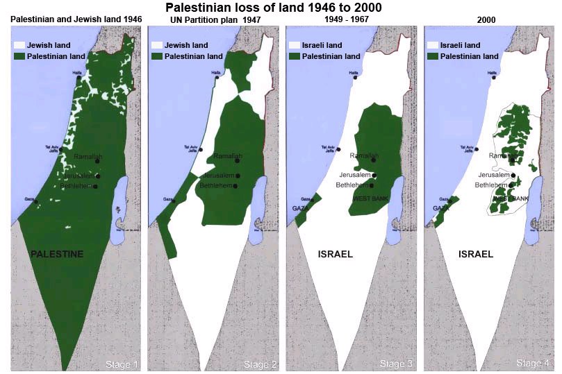
Image Source: http://forums.canadiancontent.net


Post a Comment